Fish Creek to Schuylerville
Retracing the S & S ROW - Section 3

Moving eastward from the Dyer Switch Wye in Bog Meadow, this page details the S & S ROW as it makes it's way to Victory Mills and Schulyerville.
Although much of it is highly overgrown since the abandonment, there is opportunity to see the ROW where the ROW crosses current roads. Visitors to this site are encouraged to go Google Maps or Acme Mapper and zoom in on satellite views - it is amazing to see how often it is easier to follow the ROW that way! :-)
North From Stafford's Bridge Road
Couldn't locate the continuation of the ROW north of Stafford's Bridge Road. Strangely it is marked as a road on Google Maps and the satellite view clearly shows the ROW...

End of Brown Point Lane (Trestle Over Fish Creek)
Brown Point Lane is basically the ROW. Apparently at the Fish Creek Crossing—as the aerial photos reveals—remnants of the old trestle are still visible. Due to what appears to be a proliferation of private landowners on the east side of the river, photos of the trestle seemed to be best obtained by boat.


They are posted here >
Burgoyne Road (at the turn by the river)
This particular spot was a rewarding find! The ROW was right there sandwiched between the road and Fish Creek and looked like a great spot to hike (or mountain bike) in the summer.

Burgoyne Road and Merzera Road Intersection
This was a difficult find and if it wasn't for closely reviewing the satellite maps, the ROW would have eluded us. The southeast side is completely obscured by what appears to be a combination of road fill (when the dip was upgraded) and the extended lawn of the house nearby.
Fortunately, a walk across the road revealed the ROW cut continuing diagonally in the northwesterly direction..

Hayes Road
What was interesting about this location was the radical difference between the ROW on each side of the road. On the east, the ROW was cleared and maintained as a trail. On the west side, nature had taken over and it was hard to see the ROW in comparison. If you look closely, you can discern the raised embankment (barely!).


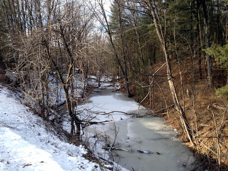
Pattersonville Road
Sadly the light wasn't great for these shots (stitched together as a panorama) - but there was a subtle beauty in the valley. especially when imagining a train chugging along on the ROW decades ago...
Scroll to the right (swipe left) to see the full panorama.
![]()

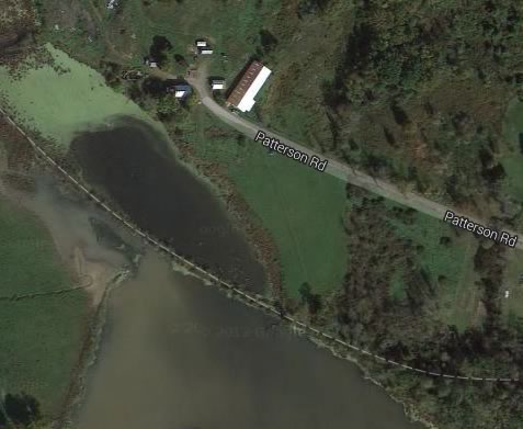
Rt 32
Can you see the ROW in this photo? Where there is a break in the embankment, it looks like there was a small bridge there as well.


Victory Mills
Victory Mills is of course dominated by the old abandoned mill, a towering discarded reminder of another era. In 1896, this 1,200-foot long building was the world's largest textile mill. From the old maps, it is apparent that the ROW passed by the west side of the building where remnants of the loading docks are still seen from Main Street.
The photo below was taken from the east side where it was easier to get a full view of the building. We spent some time exploring the immediate area and were impressed by the powerful rapids of Fish Creek—a sure sign that this location was a wise choice for a mill of this magnitude. More about the mill >
[Further photos of the mill and surrounding rapids Sidebar" ]

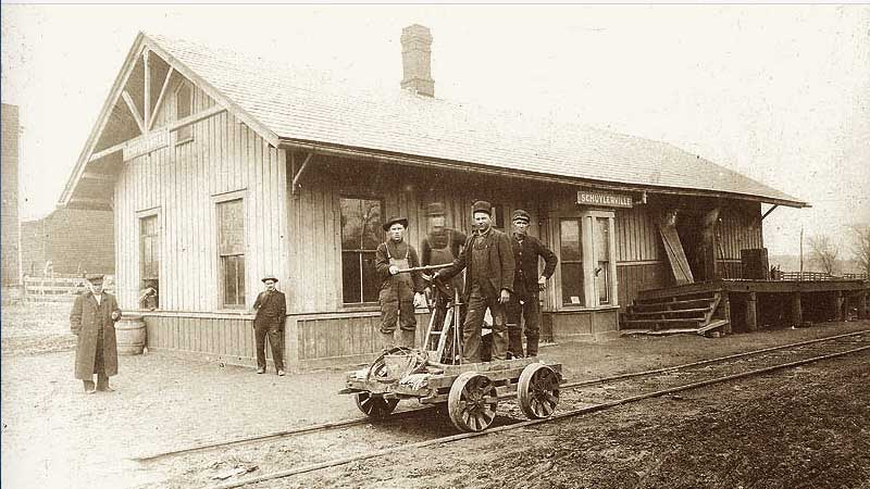
Schuylerville
From the 1900 historical map and the location of the train station still standing, it appears that Green Street was the street train traversed. We tried our best to find the matching view of David Nestle’s photo found on Gino's site and believe the small window slightly obscured by the telephone pole and the pitch of the roof and windows of the adjacent two story house match.


The end of the line
It was nice to see the old Schuylerville still standing, a poignant reminder of a different time not that long ago when folks rode the rails, life moved a little slower and our countryside wasn't criss-crossed with traffic jams and highways...
