The Saratoga & Schuylerville Railroad
About the Railroad
Although originally chartered in 1833, the Saratoga and Schuylerville (S&S) wasn't built until after the 1875. The S&S was envisioned as a link in a scheme to build a line from Boston to Buffalo. It connected Saratoga with Schuylervile and Saratoga with Mechanicville and was 26 miles long. Traffic on the S&S included primarily agricultural products and milk, plus inbound and outbound products destined for the large textile mill in Victory Mills. Map Overview >
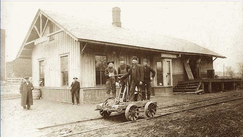
Note: The banner photo above is the Schuylerville Station, which still standing on Route 29. It is a sepia version from a collection of David Nestle.
As part of the Fitchburg Railroad system, the S&S was eventually absorbed into the rapidly expanding Boston & Maine Railroad (B&M) in 1900. When the Boston-Mechanicville route of the B&M became its mainline and the B&M focused westward from Mechanicville to Rotterdam Junction, traffic on the S&S branches declined.
In 1956, the ICC formally approved the little railroad's abandonment and by the middle of 1957, the Saratoga & Schuylerville was completely torn up and dismantled. Be sure to visit Gino's site on the S&S, There are photos, schedules, details on the dismantling, etc.
Historical Map
This map was compiled from the UNH historical topo map collection and a schedule of rail stops found on Gino's site.
![]()

Retracing the Right of Way (ROW)
Detailed satellite maps are a great tool for finding abandoned lines. As an “armchair explorer” the Saratoga & Schuylerville Railroad ROW was surprisingly easy to trace once you zoom in close. Google Maps or Acme Mapper are my tools of choice. Using Street View (when available) often gives you a clear visible picture in your mind of what to look for and expect when searching for the locations once you go out into the field.
In addition, wintertime is a good time of the year to track an old ROW. With the leaves gone, it is much easier to see the old ROWs.
- Photos -
In January of 2014, while in the area visiting my parents, I ventured out to retrace much of the ROW, snapping photos whenever possible to document my findings.

The “documented research” is divided into three sections:
Each page details the current ROW in an east to west (or north to south) sequence.