Tracing Remnants of the Shepaug Railroad (SL&N)
North of Newtown, CT
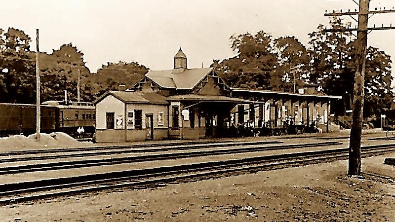
The Shepaug Railroad (the Shepaug, Litchfield and Northern Railroad) was chartered in 1866 or 1868 and operated from 1872 to its final abandonment in 1948. It interchanged with the Housatonic Railroad at Hawleyville, CT at a location further west of the Hawleyville Tunnels.
Regular service to Litchfield started in 1872. In addition to passenger traffic, the railroad shipped (1) milk south from creameries up north; (2) marble and granite from quarries near Roxbury and New Preston; and (3) ice cut from Bantam Lake. Thanks to strong milk sales during the civil war, the railroad was quite profitable.
The Shepaug was renowned for its scenic winding route—it was said that there were 192 curves along the line from Litchfield to Hawleyville or about six per mile!
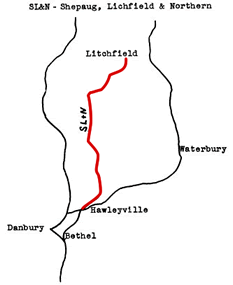
Fortunately, several miles of former SL&N track right of way are now hiking and bridle trails within the Steep Rock Association preserves today.
Bing Bird's Eye Views
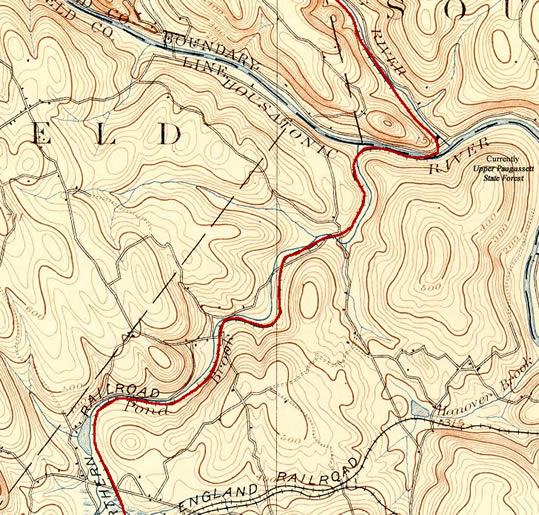
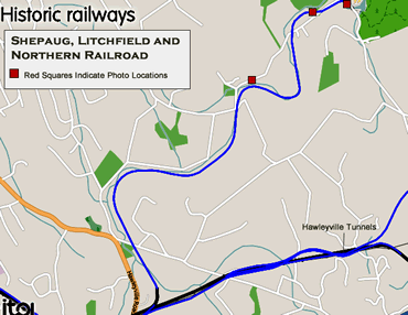
Much of the stretch of the Shepaug ROW south of the Housatonic River has long been obliterated by housing developments and nature. Fortunately—using the ITO Historic Railway Map as a guide—Bing Bird’s Eye Views shows a few remnants of the ROW. Be sure to pan, zoom and change direction of any of the views below: the "leafless" views Bing provides offers a fascinating way to discern the abandoned ROW.
- Along Pond Brook Road (parallel to the South)
- Crossing Georges Hill and Pond Brook
- View South By Stream
Photo Trek - Dec 6th, 2014
Continuing my trek from following the abandoned NY&NE (previous page), I headed up Hanover Road to Pond Brook Road and snapped a few more photos of the old Shepaug ROW. Thankfully my research on Bing (see above) proved fruitful as much of the ROW was still visible.
The ROW Follows the Northern Perimeter of the Parking Lot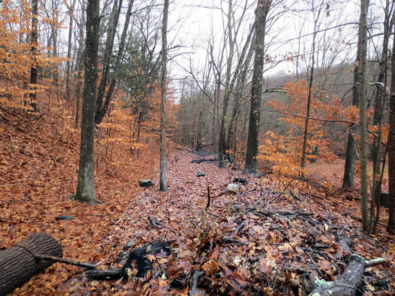
Shepaug Railroad Bridge Abutments over Pond Brook
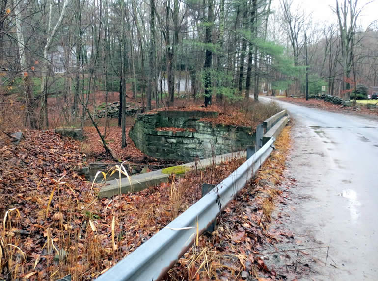
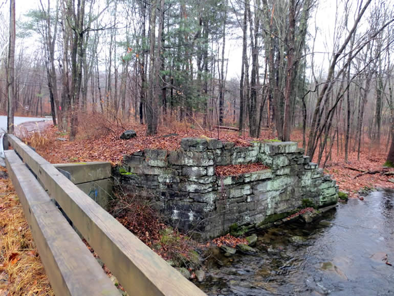
The ROW is visible just north of Pond Brook Road just after you cross over the bridge going west...
(yellow highlight added for emphasis) 
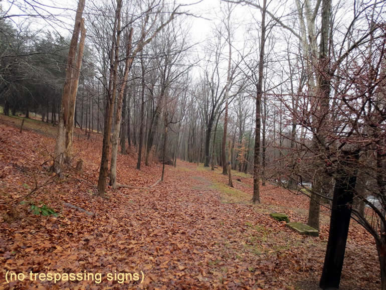
Add futher on... you can discern the ROW on the south side across the stream....
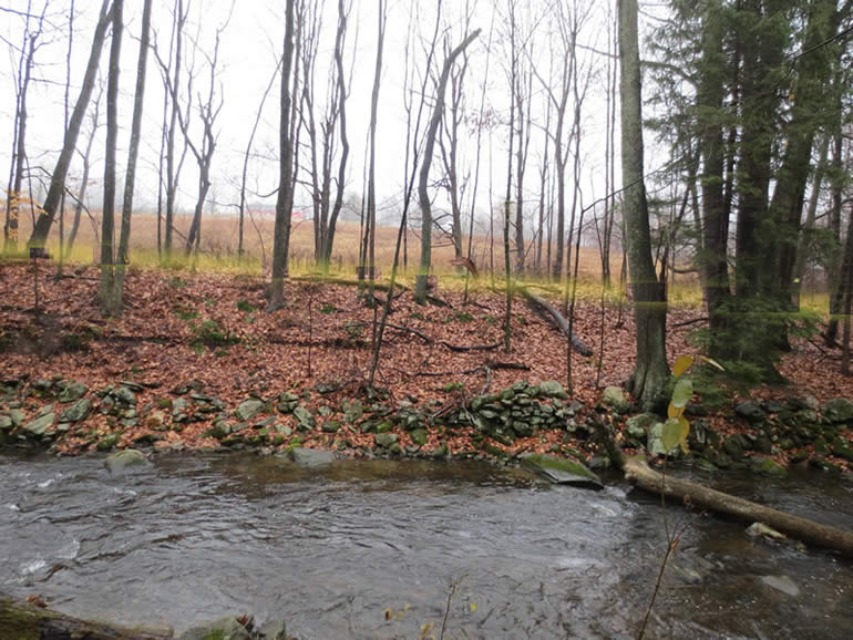
it looks very tempting to bike ride but both sides of the road are plastered with No Trespaasing Signs!
Further Info and Photos
- Shepaug, Litchfield and Northern Railroad (Wikipedia)
- Bikng on the Abandoned Right of Way (ROW)
- Steep Rock Association
North of Newtown | Hawleyville to Bethel