Please use your device in landscape view.
The Mohawk River Trolley Bridge Ruins
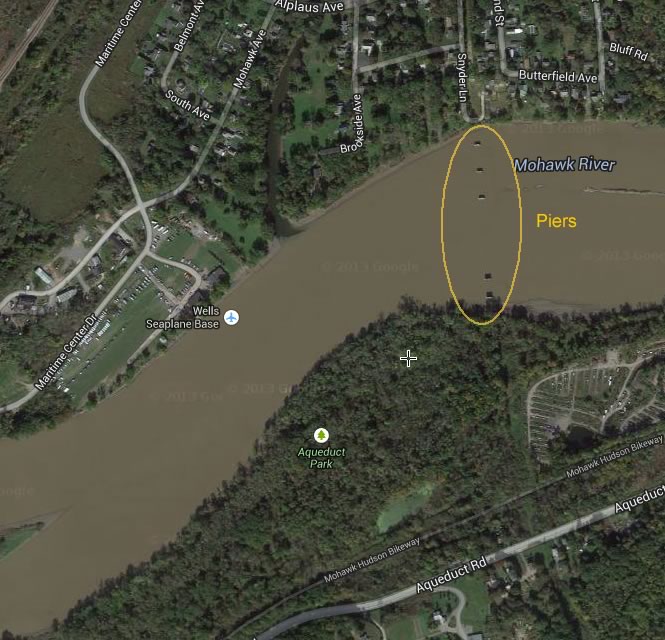
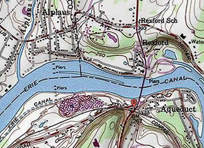
Former Trolley Bridge - Maps and Satellite Views
Often as a child, when glancing westward while crossing the Mohawk River on Rt 146, those huge piers intrigued me. I heard they were remnants of a trolley system but little else. One day I thought I will have to see them close up! Little did I know at the time that that bridge was once the longest trolley bridge in the world !
Crossing the Mohawk
The piers for the Mohawk bridge are clearly visible even in aerial satellite views.
Rollover for details
Check out the great interactive map
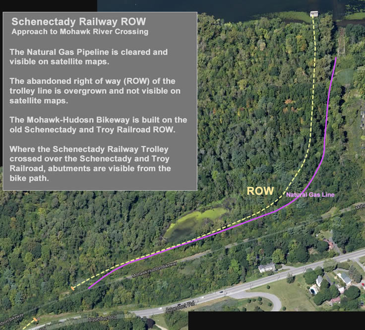
Rexford - Revealing the Trolley Bed
1930

Topo
Aerial

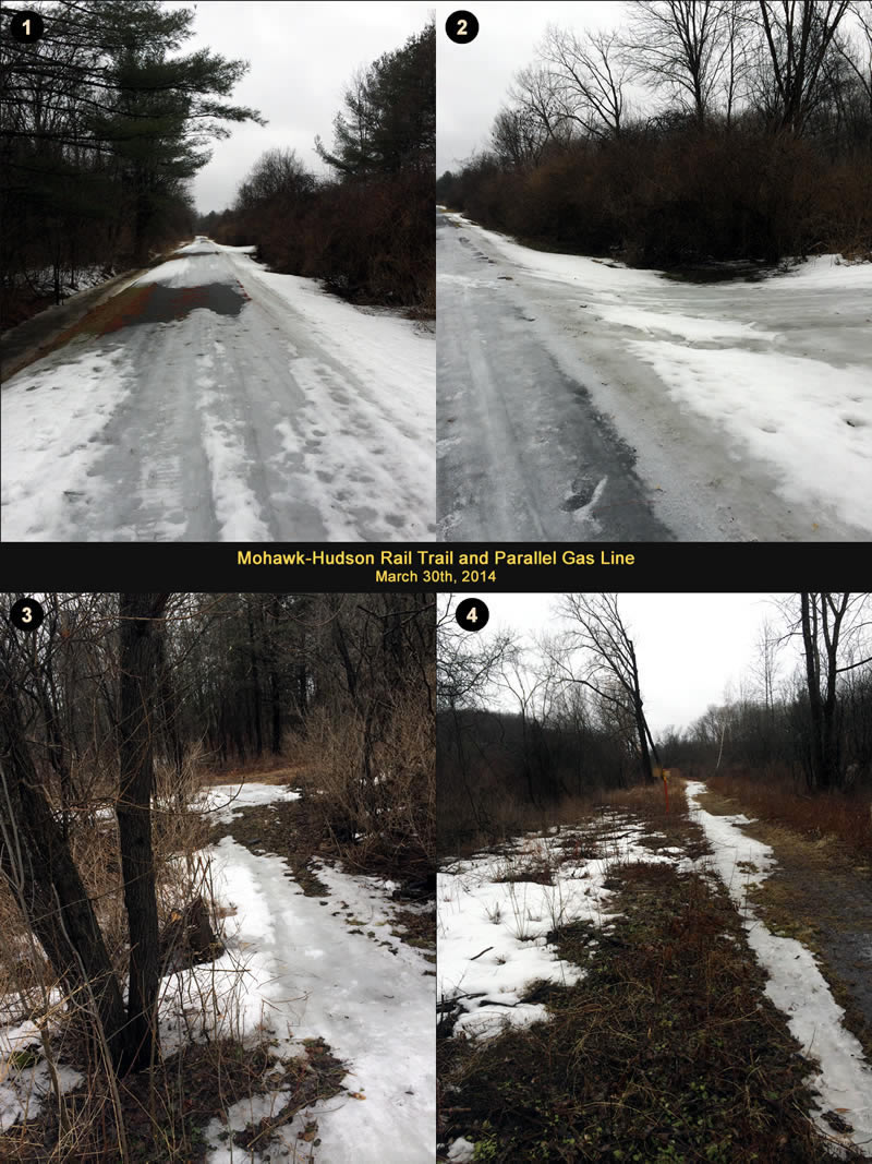
March 30th, 2014 - Morning
Ever since I saw the mysterious ruins in the woods last fall, I planned on returning and traipsing down to the river to see the trolley bridge ruins. Sadly the weather on the day I picked was very crappy: overcast with occasional sprinkles. but at least not too cold. There was of course nobody out on the trail or in the woods so I had the place all to myself...
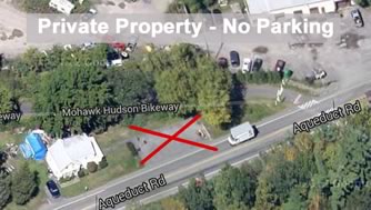
Note: The parking lot near the Rail Trail Crossing was not a public spot. Sadly, its a private lot and the owner kindly asked me not to park there.
Map Overview
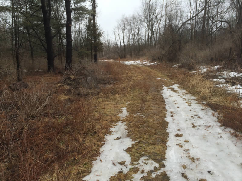
Rail Trail
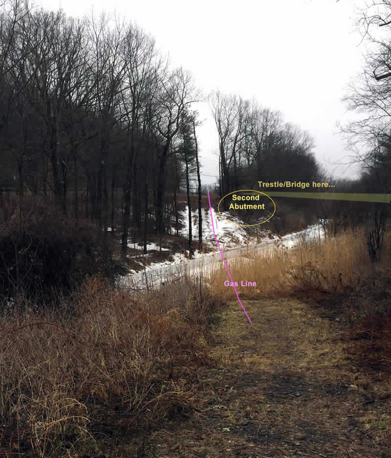
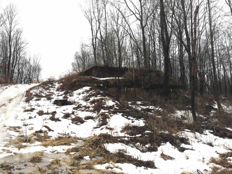
Good thing I didn’t take the bike as the rail trail was still iced over most of the way. After a 10 minute walk westward, I turned off the trail and walked on the cleared path that paralleled the trail. Turns out this was a gas line and what I had mistaken for the ROW on the satellite maps. Once I reached the abutment, I snapped a few photos then tried to worm my way back on the ROW. As the photos indicate, it was impossible. Dense scrub blocked the way...
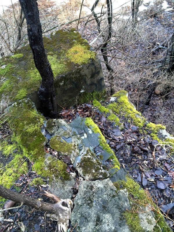
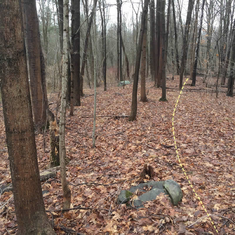
Where the Railroad and Trolley Lines Crossed
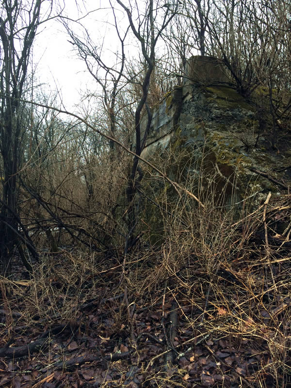
Overgrowth Obscures the ROW
Natural Gas Line
The walk on the cleared jeep road for the gas line however was super easy and only wet and muddy in a couple of spots. It curved toward the river and headed toward my destination, the Mohawk River trolley bridge ruins...
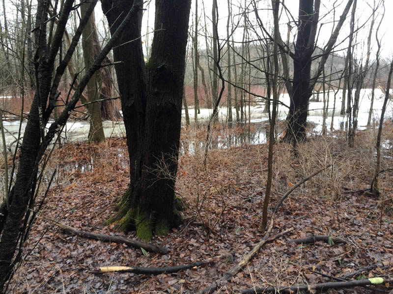
Approaching Embankment
Along the west side, the ROW embankment was tree covered and not that readily apparent. I took a short video that better illustrates the embankment.
Trolley Embankment (16 secs)
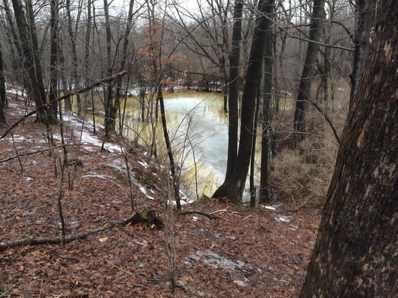
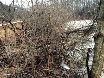
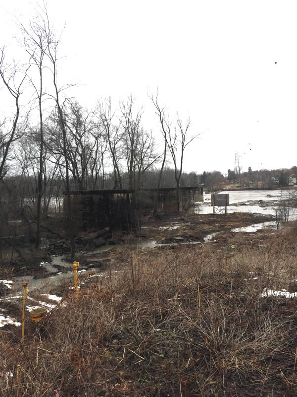
River Overlook
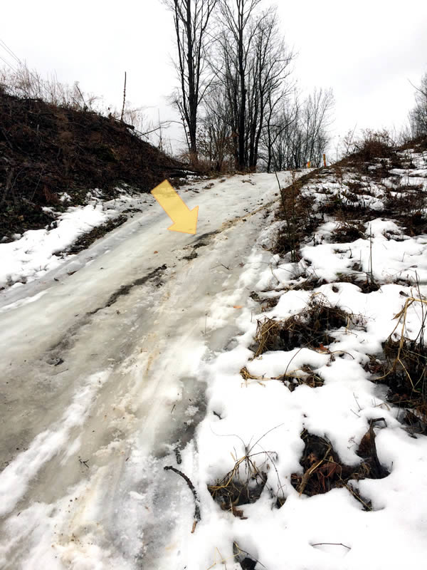
Once I neared the river, the ruins of the old trolley bridge were easy to observe but... the hill was icy and I ended up sliding down on my butt for 30 feet or so! The yellow arrow indicates the butt trail I left...
As the Acme Topo map indicates, the Old Erie Canal paralleled the Mohawk here. It looks like the canal probably passed on the south side of the top pier up the hill. Check out the short video below—the panoramic sweep gives a good overview (It was a little windy at the beginning of the video shoot, sorry).
Panoramic Sweep of the old Trolley Bridge Ruins (57 secs)
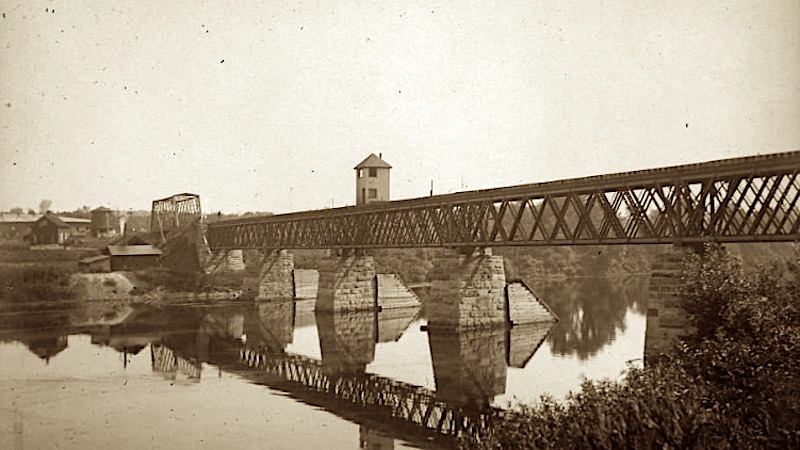
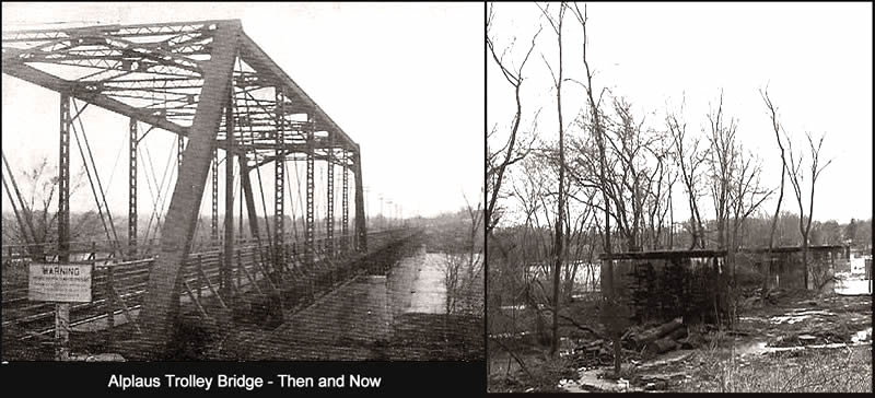
Then and Now Comparison
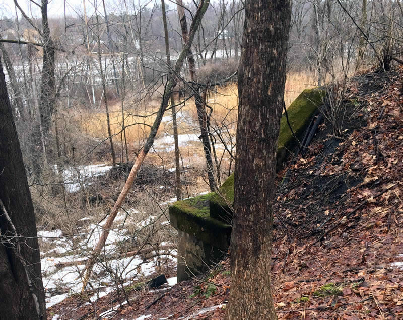
- Here’s a photo of the Trolley Bridge Piers with the Erie Canal Visible
- There's a wonderful "armchair" aerial view using GoogleMaps' Aerial View.
To get back up the hill, I made it a point to place my boots carefully on the uphill side of any saplings for whatever measly grip they may give. It was slow and cautious but it worked!

Surrounding Parkland
There was a large vernal pool west of the embankment and although there weren't any offical trails marked, there were a few offshoots here and there. A short detour around the park further up the hill confimed it is primarily a marshy area.