Retracing the New York, Housatonic and Northern Railroad
Greenwich, CT
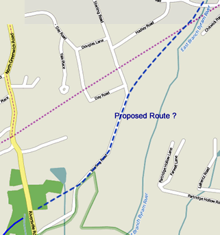
As this ITO Historic Railway map below indicates, the New York, Housatonic and Northern Railroad was proposed to cross thru northern Greenwich, CT. A total of 23 miles were supposedly graded through Westchester County and Connecticut but the line was never completed.
According to research done at the Chappaqua Library (1) much of the grade work near the present day airport was obliterated by the Tamarack Country Club; and (2) Sterling Road (now a private road) was built on the old grade.
On December 30th, 2014, I spent an hour or so driving around to each location indicated on the map where the graded ROW was purported to cross the road and saw nothing. An aerial view of the area indicates it is now populated with mansions and expansive groomed yards. I would imagine much of the man-made landscaping obliterated any traces, nevertheless...

Google Street Views 
...These Bing Bird’s Eye Views may indicate vestiges of the grade, but it is difficult to know for sure.
- Cutler Rd (Bing)
One may wonder if this elongated clearing thru the woods might have been the railroad grade
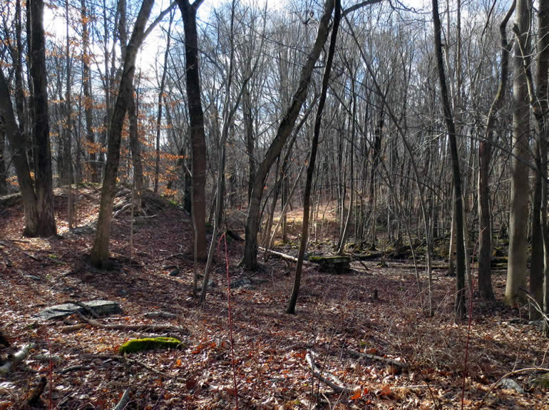
Photos "In the Field"
Curiousity got the best of me and on Dec 31st, 2014 - I drove over to the the woods area just northwest of the Greenwich Audubon Center and shot these photos. Looks like an old rail bed to me :-)


Further Info
- Proposed Route in Westchester County, NY
Historical Map > - Traces of the NYW&B/WN in Connecticut showing maps of northern Greenwich (Scroll down)